Mount Takao
Mount Takao is one of the most popular hiking destinations in Tokyo Prefecture, located just over an hour from central Tokyo. With a height of 599 meters, it offers a moderate challenge for hikers of all skill levels, and provides stunning views of the surrounding forests and cityscape.
Location and accessibility: Mount Takao is located in the western part of Tokyo, in the city of Hachioji.
It is easily accessible by train from Shinjuku Station, with regular services on the Keio Line. Once you arrive at Takaosanguchi Station, it’s just a short walk to the trailhead.
Trail options and difficulty levels: There are several trail options available for hikers, ranging from gentle paths to challenging ascents. The most popular route is the trail number 1, which is a gradual ascent with several rest areas along the way.
For those seeking a more challenging hike, the trail number 6 offers steeper terrain and requires some scrambling over rocks.

Points of interest along the trail: As you hike up Mount Takao, there are several points of interest to keep an eye out for. The first is the Yakuoin Temple, located near the base of the mountain. This temple is famous for its Tengu statues, which are said to protect the mountain.
Along the trail, there are also several rest areas and food stalls, offering refreshments and souvenirs.
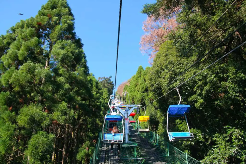
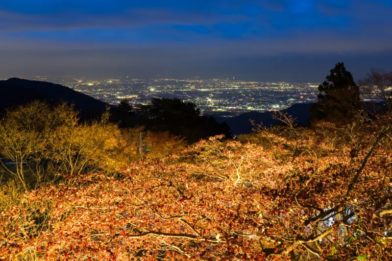
Near the summit, there is a cable car that takes visitors to the top of the mountain, offering stunning views of the surrounding landscape. At the top, there is a observation deck and a small shrine dedicated to the mountain deity.
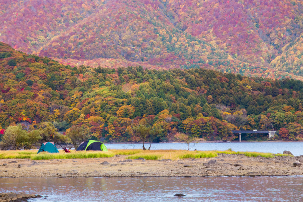
Best time to hike: The best time to hike Mount Takao is from autumn to early winter (September to December), when the leaves change color and the weather is cooler.
During this time, the mountain can get crowded with tourists, so it’s best to arrive early in the day to avoid the crowds.
Safety tips: While Mount Takao is a relatively easy hike, it’s still important to take precautions to ensure your safety.
Bring plenty of water and snacks, and wear comfortable hiking shoes with good traction. Be aware of your surroundings and watch for any signs of fatigue or injury. Finally, respect the natural environment and follow the rules and regulations set forth by the park.
Mount Mitake
Mount Mitake is a stunning mountain located in Tokyo Prefecture, with a height of 929 meters. It is located in the western part of Tokyo, in the city of Ome, and provides a challenging hike for experienced hikers.
Location and accessibility: Mount Mitake is accessible by train from central Tokyo, taking approximately 90 minutes to reach.
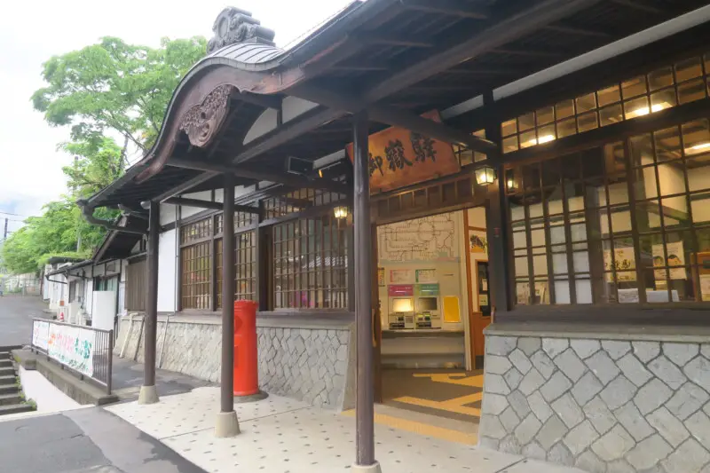
From Mitake Station, hikers can take a cable car to the trailhead, which takes approximately 6 minutes. Alternatively, hikers can choose to walk to the trailhead, which takes approximately 1 hour.
Trail options and difficulty levels: There are several trail options available for hikers, ranging from gentle paths to challenging ascents.
The most popular route is the Rock Garden Trail, which is a gradual ascent with several rest areas along the way. For those seeking a more challenging hike, the Omotesando Trail offers steeper terrain and a longer hike to the summit.
Points of interest along the trail: As you hike up Mount Mitake, there are several points of interest to keep an eye out for. The first is the Musashi-Mitake Shrine, located near the base of the mountain. This shrine is one of the oldest in Japan and is dedicated to the mountain deity.
Along the trail, there are also several rest areas and food stalls, offering refreshments and souvenirs.
At the summit, hikers can enjoy stunning views of the surrounding landscape and visit the Mount Mitake Observatory.
Best time to hike: The best time to hike Mount Mitake is from spring to autumn (March to November), when the weather is mild and the foliage is at its peak. During this time, the mountain can get crowded with tourists, so it’s best to arrive early in the day to avoid the crowds.
Safety tips: Mount Mitake can be a challenging hike, so it’s important to take precautions to ensure your safety.
Bring plenty of water and snacks, and wear comfortable hiking shoes with good traction. Be aware of your surroundings and watch for any signs of fatigue or injury. Finally, respect the natural environment and follow the rules and regulations set forth by the park.
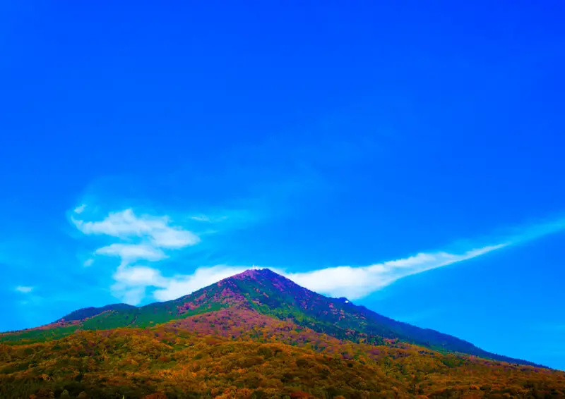
Mount Tsukuba
Mount Tsukuba is a beautiful mountain located in the Ibaraki Prefecture, just northeast of Tokyo. With a height of 877 meters, it offers a moderate challenge for hikers of all skill levels, and provides stunning views of the surrounding landscape.
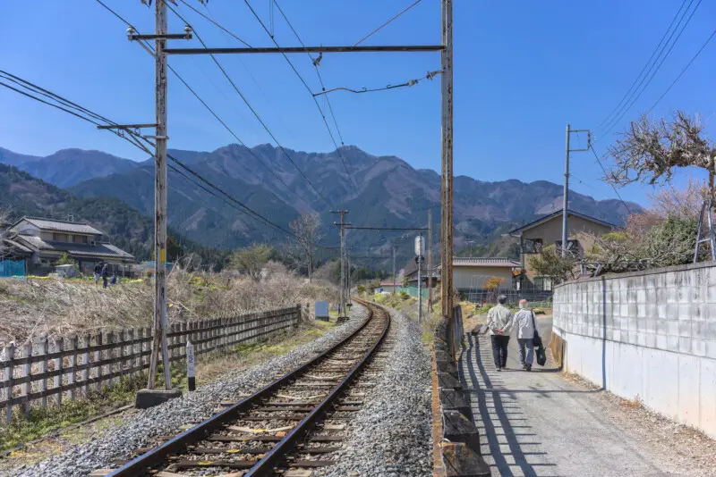
Location and accessibility: Mount Tsukuba is accessible by train from central Tokyo, taking approximately 1 hour and 30 minutes to reach.
From Tsukuba Station, hikers can take a bus or taxi to the trailhead, which takes approximately 30 minutes.
Trail options and difficulty levels: There are several trail options available for hikers, ranging from gentle paths to challenging ascents. The most popular route is the Tsutsuji-ga-oka Course, which is a gradual ascent with several rest areas along the way.
For those seeking a more challenging hike, the Nantai Course offers steeper terrain and a longer hike to the summit.
Points of interest along the trail: As you hike up Mount Tsukuba, there are several points of interest to keep an eye out for. The first is the Tsukuba Shrine, located near the base of the mountain. This shrine is dedicated to the deity of the mountain, and is one of the oldest in Japan.
Along the trail, there are also several rest areas and food stalls, offering refreshments and souvenirs. At the summit, hikers can enjoy stunning views of the surrounding landscape and visit the Tsukuba-san Shrine.

Best time to hike: The best time to hike Mount Tsukuba is from spring to autumn (March to November), when the weather is mild and the foliage is at its peak. During this time, the mountain can get crowded with tourists, so it’s best to arrive early in the day to avoid the crowds.
Safety tips: Mount Tsukuba is a relatively easy hike, but it’s still important to take precautions to ensure your safety. Bring plenty of water and snacks, and wear comfortable hiking shoes with good traction.
Be aware of your surroundings and watch for any signs of fatigue or injury. Finally, respect the natural environment and follow the rules and regulations set forth by the park.
Mount Kumotori
Mount Kumotori is one of the highest peaks in Tokyo Prefecture, with a height of 2,017 meters. It is located on the border between Tokyo and Saitama Prefectures and provides a challenging hike for experienced hikers.
Location and accessibility: Mount Kumotori is accessible by train and bus from central Tokyo, taking approximately 3 hours to reach. From Okutama Station, hikers can take a bus to the trailhead, which takes approximately 1 hour.
Trail options and difficulty levels: There are several trail options available for hikers, ranging from gentle paths to challenging ascents.
The most popular route is the Kumotori Trail, which is a gradual ascent with several rest areas along the way. For those seeking a more challenging hike, the Otentori Trail offers steeper terrain and a longer hike to the summit.
Points of interest along the trail: As you hike up Mount Kumotori, there are several points of interest to keep an eye out for. The first is the Okutama Station, located near the base of the mountain. This area offers stunning views of the Tama River and is a popular spot for photography.
Along the trail, there are also several rest areas and food stalls, offering refreshments and souvenirs. At the summit, hikers can enjoy stunning views of the surrounding landscape and visit the Kumotori Shrine.
Best time to hike: The best time to hike Mount Kumotori is from summer to autumn (June to November), when the weather is mild and the foliage is at its peak. During this time, the mountain can get crowded with tourists, so it’s best to arrive early in the day to avoid the crowds.
Safety tips: Mount Kumotori can be a challenging hike, so it’s important to take precautions to ensure your safety.
Bring plenty of water and snacks, and wear comfortable hiking shoes with good traction. Be aware of your surroundings and watch for any signs of fatigue or injury. Finally, respect the natural environment and follow the rules and regulations set forth by the park.
Mount Oyama
Located in the southern part of Tokyo Prefecture, Mount Oyama is a popular hiking destination known for its stunning views and lush forests.
With a height of 1,252 meters, it offers a moderate hike that is suitable for hikers of all levels.
Location and accessibility: Mount Oyama is located in the city of Isehara in Kanagawa Prefecture, just south of Tokyo. It is easily accessible by train, with the nearest station being Isehara Station. From there, hikers can take a bus or taxi to the trailhead, which is located at the foot of the mountain.
Trail options and difficulty levels: There are several trail options available for hikers, ranging from gentle walks to steep climbs. The most popular route is the Omotesando Trail, which is a gradual ascent that takes approximately 2-3 hours to reach the summit.
For those seeking a more challenging hike, the Mukashi-michi Trail offers steeper terrain and a longer hike to the summit.
Points of interest along the trail: As you hike up Mount Oyama, there are several points of interest to keep an eye out for. The first is the entrance to the mountain, which features a torii gate and several food and souvenir shops.
Along the trail, there are also several rest areas and food stalls, offering refreshments and souvenirs.
At the summit, hikers can enjoy stunning views of the surrounding landscape and visit the Oyama Afuri Shrine, which is dedicated to the god of mountains. The shrine features a large wooden torii gate and several other structures that are steeped in history and tradition.
Best time to hike: The best time to hike Mount Oyama is from spring to autumn (March to November), when the weather is mild and the foliage is at its peak.
During this time, the mountain can get crowded with tourists, so it’s best to arrive early in the day to avoid the crowds.
Safety tips: Mount Oyama is a relatively easy hike, but it’s still important to take precautions to ensure your safety. Bring plenty of water and snacks, and wear comfortable hiking shoes with good traction.
Be aware of your surroundings and watch for any signs of fatigue or injury. Finally, respect the natural environment and follow the rules and regulations set forth by the park.
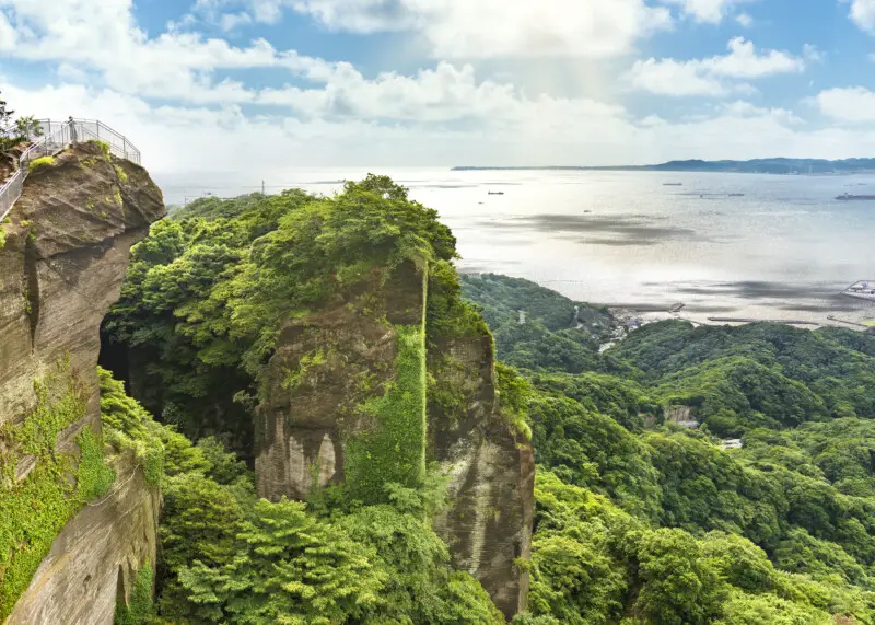
Mount Nokogiri
Located in Chiba Prefecture, just east of Tokyo, Mount Nokogiri is a unique hiking destination known for its impressive cliffside carvings and stunning views of Tokyo Bay. With a height of 329 meters, it offers a moderate hike that is suitable for hikers of all levels.
Location and accessibility: Mount Nokogiri is located in the city of Futtsu in Chiba Prefecture, about 80 km east of Tokyo.
The easiest way to get there is by taking the Keikyu Line from Shinagawa Station to Hama-Kanaya Station, then transferring to the bus that takes you directly to the mountain’s trailhead.
Trail options and difficulty levels: There are several trail options available for hikers, ranging from gentle walks to steep climbs. The most popular route is the Nihon-ji Temple Trail, which is a gradual ascent that takes approximately 1.5-2 hours to reach the summit.
For those seeking a more challenging hike, the Kamegamori Trail offers steeper terrain and a longer hike to the summit.
Points of interest along the trail: As you hike up Mount Nokogiri, there are several points of interest to keep an eye out for. The first is the Nihon-ji Temple, which is home to over 1,500 stone statues of Buddha and other Buddhist deities.
At the summit, hikers can enjoy stunning views of Tokyo Bay and visit the Nokogiri-yama Ropeway, which takes visitors up to a viewing platform that offers panoramic views of the surrounding landscape.
One of the most unique features of Mount Nokogiri is the Jigoku Nozoki (Hell’s Peek), a section of the trail that features a sheer cliff face with a hole drilled through it.
From this hole, hikers can look down into a 60-meter deep pit, giving the impression of looking into the depths of hell.
Best time to hike: The best time to hike Mount Nokogiri is from spring to autumn (March to November), when the weather is mild and the foliage is at its peak. During this time, the mountain can get crowded with tourists, so it’s best to arrive early in the day to avoid the crowds.
Safety tips: Mount Nokogiri is a relatively easy hike, but it’s still important to take precautions to ensure your safety.
Bring plenty of water and snacks, and wear comfortable hiking shoes with good traction. Be aware of your surroundings and watch for any signs of fatigue or injury. Finally, respect the natural environment and follow the rules and regulations set forth by the park.
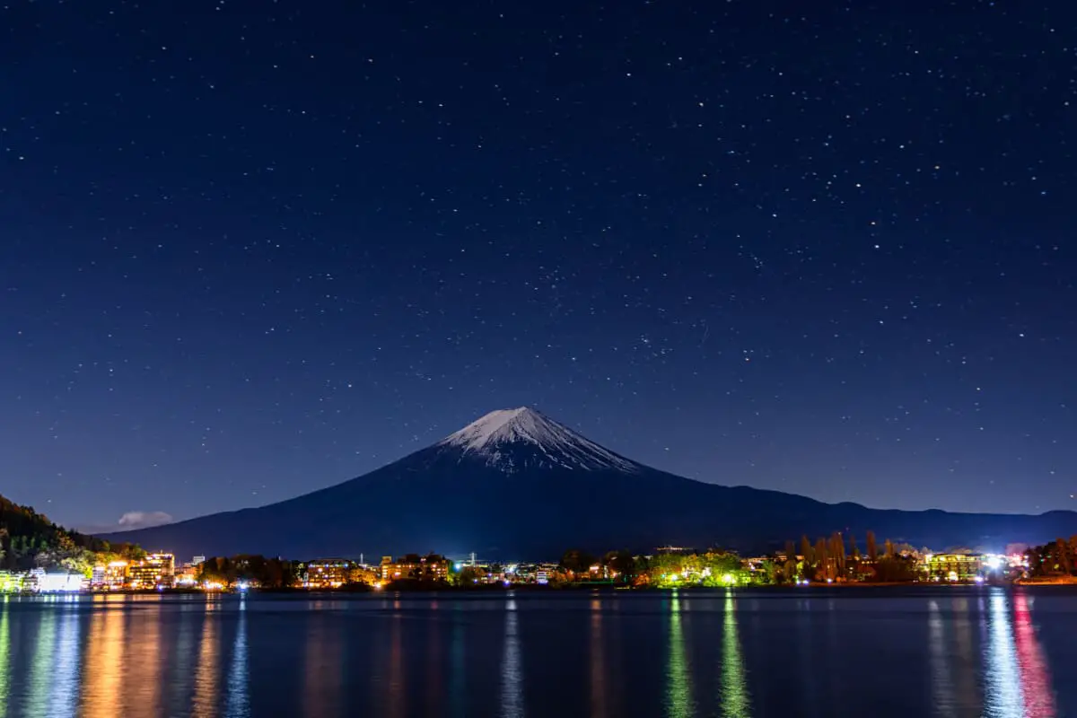
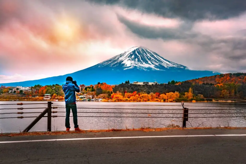
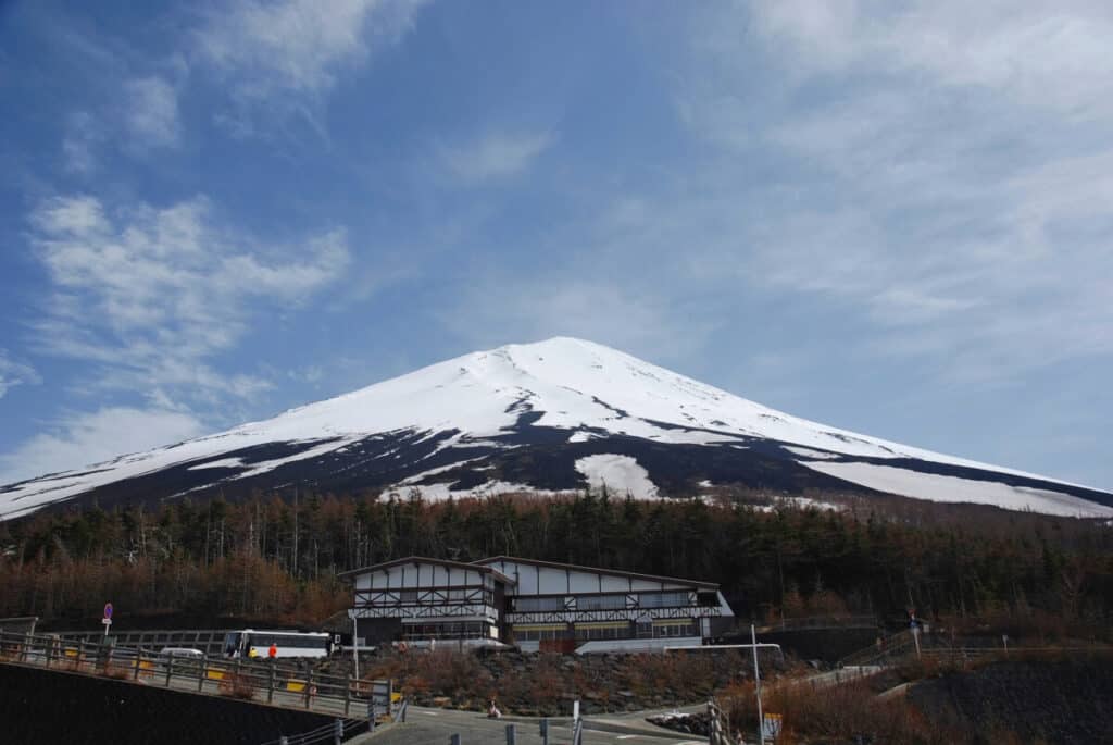
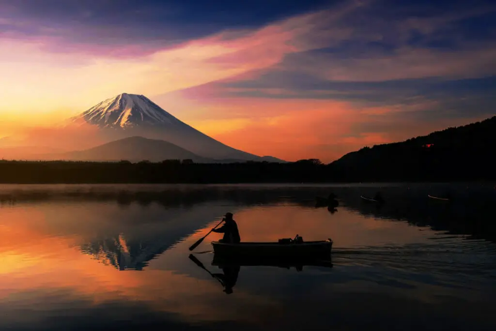
Mount Fuji (from Tokyo Prefecture)
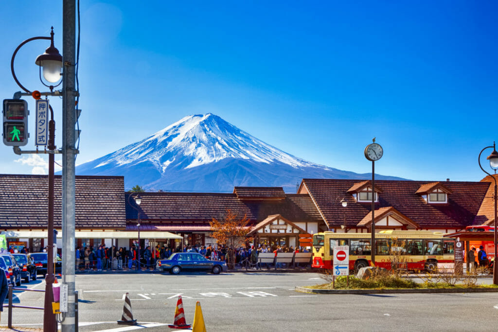
Mount Fuji, standing at 3,776 meters, is the highest mountain in Japan and a UNESCO World Heritage site. While Mount Fuji is technically located in Yamanashi and Shizuoka prefectures, it is easily accessible from Tokyo and is a popular hiking destination for visitors and locals alike.
Location and accessibility: Mount Fuji is located approximately 100 km southwest of Tokyo and is easily accessible by train or bus.
The most popular starting point for hiking Mount Fuji is the Kawaguchiko 5th Station, which can be reached by bus or car from Tokyo.
Trail options and difficulty levels: There are several trails available for hikers to reach the summit of Mount Fuji, but the most popular route is the Yoshida Trail, which begins at the Kawaguchiko 5th Station.
The trail is approximately 14 km in length and takes an average of 5-8 hours to complete, depending on fitness level and weather conditions. While the Yoshida Trail is a relatively easy hike, it’s important to note that the altitude can cause altitude sickness for some hikers.
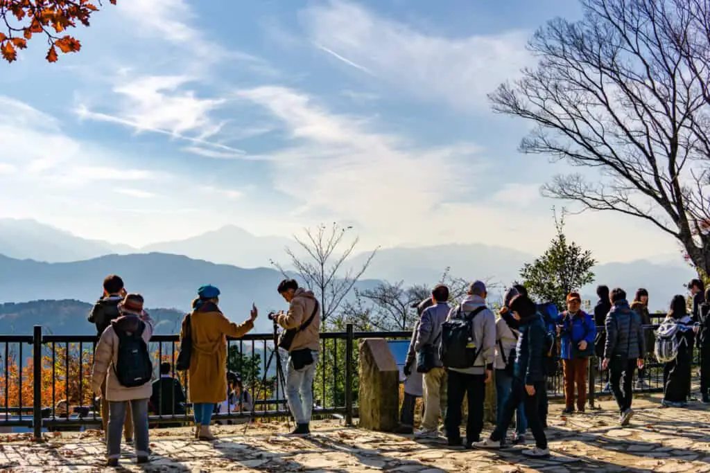
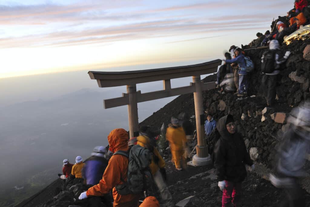
Points of interest along the trail: As hikers ascend Mount Fuji, they can enjoy breathtaking views of the surrounding landscape and unique rock formations. One popular stop along the trail is the Fujisan Hongu Sengen Taisha Shrine, located at the Kawaguchiko 5th Station.
The shrine is a traditional Japanese shrine dedicated to the goddess of Mount Fuji and is a popular spot for hikers to pray for a safe journey.
At the summit, hikers can enjoy the stunning panoramic views of the surrounding area, including Lake Kawaguchi and the Fuji Five Lakes. There is also a post office at the summit where hikers can send postcards back home with a special Mount Fuji postmark.
Best time to hike: The best time to hike Mount Fuji is from early July to mid-September, when the weather is mild and the trails are open. However, it’s important to note that this is also the peak hiking season, and the trails can become crowded.
Hikers should also be aware that weather conditions on Mount Fuji can change rapidly, and it’s important to check the weather forecast before embarking on the hike.
Safety tips: Hiking Mount Fuji can be a challenging experience, and it’s important to take precautions to ensure your safety. Hikers should be prepared for changes in weather conditions and should dress in layers to stay warm.
It’s also important to bring plenty of water and snacks and to pace yourself to avoid altitude sickness. Finally, hikers should respect the natural environment and follow the rules and regulations set forth by the park.
Final Thoughts On Tokyo Prefectures Mountains
Tokyo Prefecture offers a variety of breathtaking mountains for hiking enthusiasts to explore. From the iconic Mount Fuji to the lesser-known Mount Mitake, each mountain offers its own unique beauty and challenges.
For those seeking an easier hike, Mount Mitake and Mount Tsukuba are great options with relatively gentle trails and stunning views.
For those seeking a more challenging experience, Mount Kumotori and Mount Nokogiri offer steep ascents and rugged terrain.
While each mountain has its own points of interest, including shrines, waterfalls, and rock formations, all of them provide the opportunity to connect with nature and enjoy the peacefulness of the Japanese mountains.
It’s important to note that hiking in the mountains can be dangerous, and it’s important to take necessary precautions, such as checking the weather forecast, bringing appropriate gear and supplies, and respecting the natural environment.
Overall, Tokyo Prefecture offers an abundance of mountain hiking opportunities for both novice and experienced hikers.
Whether you’re looking to climb Japan’s highest peak or explore the hidden treasures of lesser-known mountains, there’s something for everyone to enjoy in this beautiful region of Japan.